Feeds:
Posts
Comments

Mount Judge Howay

Location: Southwestern British Columbia, near Stave Lake
Elavation: 2,262 metres
Range: Garibaldi Ranges, Coast Mountains
Candidate: #53

You could almost wish to leave this mountain off the list because it can be seen up close from a limited area that is mostly difficult to reach and climbing it is even more difficult, partly due to the “multi-modal” access, as Bivouac puts it. Yet this mountain deserves its candidacy, I believe, because it is a) very beautiful in form and appearance, b) a worthy challenge for those who do wish to climb it, c) a prominent peak both topographically (1,627 metres of prominence) and visually when viewed from other peaks in the Greater Vancouver Area, and d) its namesake is related to another beautiful and known mountain, Mount Robie Reid.

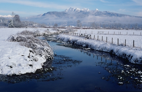
Mount Judge Howay – The Judge – is a spectacular twin-peaked mountain located at the far end of Stave Lake. Access is generally by canoe, crossing the lake, followed by hike up deactivated logging roads, next a fording of the Stave River, a bushwhack up through forest with cliff bands and rocky outcroppings, a ridge walk, and finally rock climbing to the summit. It’s a fair assumption that few actually attempt and reach either of the two summits, though its difficulty apparently taunt the minds of many climbers who are up for the challenge.

Originally know as the Snow Peaks, along with Mount Robie Reid, the mountain was named after judge and jurist, Frederic W. Howay, who was also a noted historian of British Columbia. He and his colleague Robie Reid, ran a law firm together from 1893 to 1906 before Howay was appointed to the bench. Both mountains were renamed in 1944.

For a detailed account of an ascent of the South Peak, go here.

Photos:

100 Mountains of Canada on Flickr

Resources:

Bivouac

Wikipedia

PeakBagger trip report

South Peak ascent

Proposal for Golden Ears Provincial Park and Mount Judge Howay recreation area (offers details on the area)
Mount Robie Reid

Location: Golden Ears Provincial Park, British Columbia
Elevation: 2,095 metres
Range: Garibaldi Ranges, Coast Mountains
Candidate: #52

Dominating the mountain view from Abbotsford and peering up from behind the peaks of Golden Ears when viewed from further west, Mount Robie Reid is a glacier-carved mountain massif with impressive features and one of the several rugged-looking peaks visible from around the Fraser Valley. The northeast face of the mountain boasts a rock wall that is nearly 1,700 metres and is the biggest rock wall so near Vancouver.

Though access to the mountain can be gained by boat across Alouette Lake, there is a trip report on Club Tread that says the forest service road from Stave Lake is in very good condition and a 2WD vehicle can manage the way. Though that party didn’t make it above the tree-line due to the weather, photos and Google maps provide information. Bivouac reports a hike and a scramble to the base of the summit pinnacle, which is from there a Class 4 climb to the top.

The mountain was previously known as one of the Snowy Peaks along with its neighbour Mount Judge Howay, and referred to as “Old Baldy” by old-timers. It was renamed in 1944 to commemorate historian Robie Lewis Reid, who along with his close friend and colleague Frederic W. Howay were the only two to graduate from the provincial examinations for a First Class permanent teaching certificate in 1885. They went on to study at Dalhousie University in Halifax and started a law firm together in 1893 in New Westminster, which remained a partnership until Howay was appointed to the bench in 1906. Interestingly, the two mountains which are so close to each other were named after the two close friends, Mount Judge Howay being the slightly higher summit just as the man Judge Howay had achieved a higher stature in his career.

References:

Bivouac

Wikipedia

ClubTread

Photos:

100 Famous Mountains of Canada on Flickr

Mount Seymour

Location: British Columbia, MountSeymourProvincialPark

Elevation, 1,449 metres

Range: CoastRange, PacificRanges, Fannin Range

Candidate: #51

Vancouver has three mountains for winter recreation: Cypress Mountain, Grouse Mountain, and Mount Seymour. All three mountains also offer summer activities as well. Each mountain has its own claim to fame. Cypress Mountain has a trail accessing the Lions; Grouse Mountain has a cable car and well-developed tourist area as well as the famous Capilano Canyon and its suspension bridge below its south west side, in the City of North Vancouver; and Mount Seymour is in a provincial park. Of the three peaks, Mount Seymour was the one that dominated the view from my living room window when I grew up. From my perspective, it seemed to be the most prominent and the highest of the North Shore Mountains.

Though first ascended in 1908 by the BC Mountaineering Club, it was largely unknown to Vancouverites until a ski resort was opened in 1938. The mountain has many well-established ski, cross country ski, and snowshoe routes but each year rescue teams have to look for skiers and others who have fallen into couloirs or who have wandered off the track and gotten lost. Thanks to auto access to the ski resort, its very easy to drive most of the way up the mountain. There are three peaks and the Third Pump Peak is the true summit. The Suicide Bluffs are a good place to practice rock climbing, and in winter ice climbing.

As a provincial park, the mountains slopes protect many species of trees and vegetation, and many wild animals. On the west side is the smaller cousin to Capilano Canyon, called Lynn Canyon. It’s famous not only for its beauty but for the dangerous sport of canyon diving which has claimed the lives of a few young people over the decades. There are also hiking trails into the backcountry. Near Rice Lake, a marker commemorates a plane crash that occurred just north of Seymour. The mountain was named after Frederick Seymour, Governor of British Columbia from 1864 to 1869.

The granite of Mount Seymour is part of the great granite intrusion that makes up the Coast Range batholith. The North Shore Mountains experienced heavy glaciation during the last ice age.

References:

BC Parks

Wikipedia

Vancouver Trails

Trek It Now

Outdoor Vancouver

Photos:

Flickr 100 Mountains of Canada

Next:

Mount Robie Reid

Mount Cheam

Location: British Columbia, east end of the Fraser Valley
Elevation: 2,104 metres
Range: North Cascades
Candidate: #50

The Fraser Valley is surrounded by mountains to the north and east and there are mountains to the southeast in Washington State and to the far west on Vancouver Island. Of all the many peaks visible, there are a few that truly stand out for their individual beauty in shape and form, and Mount Cheam is one of them. Situated at the eastern end of the Fraser Valley, in Chilliwack, and standing watch over the valley, Mount Cheam’s distinctive north face makes it an easily recognizable mountain – a steep drop plummets 2,000 metres to the Trans Canada Highway below.

Details behind the name “Cheam” are given on Wikipedia and Bivouac. I’m afraid I can’t provide all the correct accent marks for the names of the First Nations people who had names for this mountain, but “Cheam” means wild strawberries in the Halkomelem language. For the Sto:lo, it was the ‘mother mountain’ with neighbouring Lady Peak being the woman’s dog. Mount Cheam or Cheam Peak is the farthest northerly peak of the Cheam Range. It is not the highest peak but because of its beautiful pyramid shape and prominent position near a heavily populated area, it makes for a good candidate for the list of 100 mountains.

There is a fairly easy hiking trail that is only accessible by 4WD vehicles on a logging road. The hike to the summit passes through an alpine slopes that bloom full of yellow avalanche lilies. From the summit there is a 360-degree view of the Fraser Valley and the surrounding mountains. A trail also connects to Lady Peak, Knight Peak, and beyond. For details on how to get there and the 4.5-hour round trip hike, please see the references below.

One interesting piece of information that came up was the case of a plane crash in the area. It seems that some 70 to 50 years ago there were a few plane crashes in the Canadian Cascades and the North Shore mountains, and one plane is said to have crashed near Knight Peak. Hikers report having spotted airplane aluminium near the trail. Another report tells of a crash near Mount Sleese. It seems as though these beautiful mountains were also death traps for early aviators in the area.

References:

Vancouver Trails

Wikipedia

Trail Peak

Club Tread

Bivouac

Photos:

Flickr 100 Mountains of Canada

Next: Mount Seymour

Frosty Mountain

Location: Manning Provincial Park, British Columbia
Elevation: 2,408 metres (east summit and officially named summit)
Range: North Cascades
Candidate: #49

When I was growing up, Manning Park was a popular place to camp with my family. Only three hours away by car, the Lightning Lake campsite was our usual spot because we had a canoe and always included a paddle on the lake in our outdoor experience. Forested mountains surround the lake and from certain viewpoints Frosty Mountain’s bare rocky peak can be seen above all others.

Though I have regrettably never climbed it, there is a good trail from Lightning Lake leading to Camp Frosty where tents can be pitched. There’s a very nice family hike account of the climb to the camp and the summit here. As with many hikes in Canada, there are a number of switchbacks up the steeper parts and near the rocky summit the path becomes somewhat dangerous due to the amount of loose rock. The course goes through forest, sub-alpine, and alpine to the summit. The length is 22.2 km from Lightning Lakes and is said to take 9 hours round trip for those who don’t camp on the mountain. Worthy of mention is a stand of larch trees that are said to be among the oldest in Canada, dating back some 2,000 years!

An interesting note about the summit elevation: Frosty Mountain has actually two summits and the lower east summit is the one labelled “Frosty Mountain” on the map, according to bivouac.com. The west summit is slightly higher, reaching 2,426 metres (or 2,423 metres depending on the web site) and it is labelled “7950” on the map. The family account mentioned above shows a photo on the summit with the marker in the photo reading “2,408 m”. Frosty Mountain is the highest peak within Manning Provincial Park.

The mountain is composed of up-thrust sedimentary rock from the ancient Methow Ocean. On a train near Lightning Lake, there is a sign mentioning fossils on the area. I happened to once find a good sized chunk of rock full of black seashell fossils there.

Sources:

Frosty Mountain hike

E.C. Manning Provincial Park

Club Tread

Hike Chilliwack

Bivouac

Photos:

Flickr 100 Mountains of Canada

Next: Mount Cheam

Golden Ears Mountain

Location: Golden Ears Provincial Park, British Columbia
Elevation: 1,716 metres
Range: Coast Mountains, Garibaldi Ranges
Candidate: #48

One of those mountains that stand out from all the visible peaks of around the Fraser Valley is Golden Ears Mountain and its sub-peaks of Edge Peak and the Blanshard Needle. Together, the three peaks provide a beautiful backdrop to so many typical Fraser Valley scenes. When the Fraser Valley Real Estate Board asked me to shoot an instantly recognizable Fraser Valley view, I gave them a shot of Golden Ears standing behind a new housing estate and they used it on the cover of a publication. I made four attempts to climb the mountain but only made it on the fourth because the previous attempts had been too early in the year and I was not prepared for snow. I reached the summit in clouds and failed to see the view over the Fraser Valley. But Golden Ears Mountain has always been one of the mountains that drew my eye for so many years of my life.

Golden Ears is only 1,716 metres high but it rises up from the Fraser Valley and has a prominence of 1,002 metres! The original English name was Golden Eyries, probably for the eagles that were often seen soaring in the area. At first the whole area was called the Golden Eyries but later the area was called Mt. Blanshard and the Golden Eyries was corrupted to Golden Ears, the name given to the highest peak with the twin summits. Some people suggest that the two summits appear golden when they catch the light of the setting sun.

The mountain is the highpoint between Pitt Lake and Gold Creek and because it is visible from almost anywhere in the Greater Vancouver Area, it is also a popular hiking destination. A trail with a 1,500 metre elevation gain follows Gold Creek and partway up there is a tenting area in the Alder Flats. An emergency shelter sits further up the mountain. The last stretch to the summit requires a little scrambling. The mountain was first climbed in 1911 by a BCMC party.

Golden Ears1

Sources:

Wikipedia

Bivouac

Summitpost

Photos:

Flickr 100 Mountains of Canada

Next: Frosty Mountain

Moving On…

The Rocky Mountains have so many beautiful peaks to add to this list. However, I have been eager to move on to other parts of Canada and I am now looking at the mountains closest to my “home” in Southwestern British Columbia. The first post is ready and I will be looking at nearly a dozen mountains in the area and nearby ranges. So, for now, we will leave the Rockies behind.

Vimy Peak

Location: Waterton Lakes National Park, Alberta
Elevation: 2,379 metres
Range: Border Ranges, Canadian Rockies
Candidate number: 46

When driving into Waterton Lakes National Park, one is struck by the abrupt change from Prairie to mountain. Down here in south western Alberta, snug against the Montana border, there is barely the raising of a hill before the stratified cliffs and slopes of the Rocky Mountains rear up from the earth. In other places, a series of foothills usually precedes the rugged peaks. As one nears the town site of Waterton Lakes, the great Vimy Peak can be clearly seen overlooking the town. Part of a long ridge of the same name, Vimy Peak at the north east end of the ridge is actually a little lower than the south west end, which rises to 2,500 metres.

The mountain was originally named Sheep Mountain and that’s how it appears on George Dawson’s map of 1886. Later it became Goat Mountain. Then in 1917, the mountain was renamed in honour of the Canadian soldiers who took Vimy Ridge in France in WWI after the British and the French had failed.

The peak can be climbed via the 16-kilometre round trip Wishbone Trail from the Chief Mountain International Highway. Detailed directions are given on SummitPost. The view from the top looks over the Waterton town site and the surrounding mountains, as well as over the Prairies, which stretch out before the mountain.

Photos:

100 Famous Mountains of Canada at Flickr

Sources:

SummitPost

PeakFinder

Bivouac

Peakware

Next: Golden Ears Mountain

Mount Blakiston

Location: Waterton Lakes National Park, Alberta

Elevation: 2,910 metres

Range: ClarkRange, Canadian Rockies

Candidate number: 45

MountBlakiston is the highest point within WatertonLakesNational Park. The mountain can be viewed on the road in to WatertonLakes and from the road to RedRockCanyon. Among the typical sedimentary layers typical of mountains in the Rockies, MountBlakiston’s layers include an intrusion of diabase, a volcanic rock that was squeezed in between the sedimentary layers. This greenish-black relative of basalt can be seen in the east and south facing cliffs. There is a steep but frequently-climbed scramble route to the summit and routes leading to neighbouring Mounts Hawkins and Lineham.

The mountain was named after Thomas Blakiston, a very remarkable man who explored the area as an intended member of the Palliser expedition in 1858. He was recommended for the expedition by Sir Henry Lefroy as a magnetic observer and was also to see if there wasn’t a suitable route for a transcontinental railway. During the expedition, however, Blakiston had some differences with expedition leader, John Palliser, and once on his way to the Rockies, he sent a letter telling Palliser that he had thrown off Palliser’s command. Blakiston followed the eastern edge of the Rockies and explored CrowsnestPass and KootenayPass and determined the area to be within BritishTerritory, therefore suitable for a railway. He refused to give his observations to John Palliser and in 1859 returned to England to hand over his documents on his own. He later explored the Yangtze River in China and then spent time in Japan compiling a catalogue of Japan’s birds. A brief detail of his accomplishments is mentioned on Peakfinder.

Sources:

Peakfinder

Peakware

SummitPost

Wikipedia

Bivouac

Photos:

100 Famous Mountains of Canada on Flickr

Next: Vimy Peak

Mount Joffre

Mount Joffre

Location: Peter Lougheed Provincial Park, Alberta/British Columbia
Elevation: 3,449 metres (or 3,450 metres, depending on the source)
Range: Canadian Rockies, Continental Divide
Candidate #44

Mount Joffre is situated in a group of mountains known as the World War One General group. Named after the French field marshal, Marshal Joseph Jaques Cesaire Joffre, Mount Joffre is the highest peak in the generals group and the highest between Mount Assiniboine and the U.S. border. It is ice-covered on the north, east, and south east sides with ice fields and glaciers and holds the largest accumulation of ice in the southern Rockies. The west face presents a formidable rocky face.

Scramblers will be glad to know that it is possible to reach the summit via two different routes that are not too difficult, though crampons and other essential scrambling gear is required. The east route follows the snow-covered ridge and the southeast route climbs a scree slope. The summit is snow-covered. There are excellent views of Elk Lakes Provincial Park and Sylvan Pass, and the ridge makes a fairly easy route to reach other mountains, according to one source. The climb is normally done from Aster Lakes and the Mangin Glacier.

The mountain is somewhat remote and can only be seen from Highway 40 for a short distance two kilometres north of the junction with the Kananaskis Trail. Another mountain named Mount Joffre is in the Coast Mountains of British Columbia.

Photos:

100 Famous Mountains of Canada Flickr

Sources:

summitpost

wikipedia

peakware (note the photo here is of another Mount Joffre)

bivouac

peakfinder

peakery

Next:

Mount Blakiston